Camino portugues Guide

Table of contents
Guide
Porto - Vila do Conde [29.7 km]
Vila do Conde - Barcelos [28.4 km]
Barcelos - Ponte de Lima [24 km]
Ponte de Lima - Tui (Spain) [35 km]
Tui - Redondela [35 km]
Redondela - Pontevedra [20.6 km]
Pontevedra - Padron [40.7 km]
Padron - Santiago [20 km]
What is the Camino Portugues?
If you are not familiar with the Camino de Santiago you can read more about it in our article here.
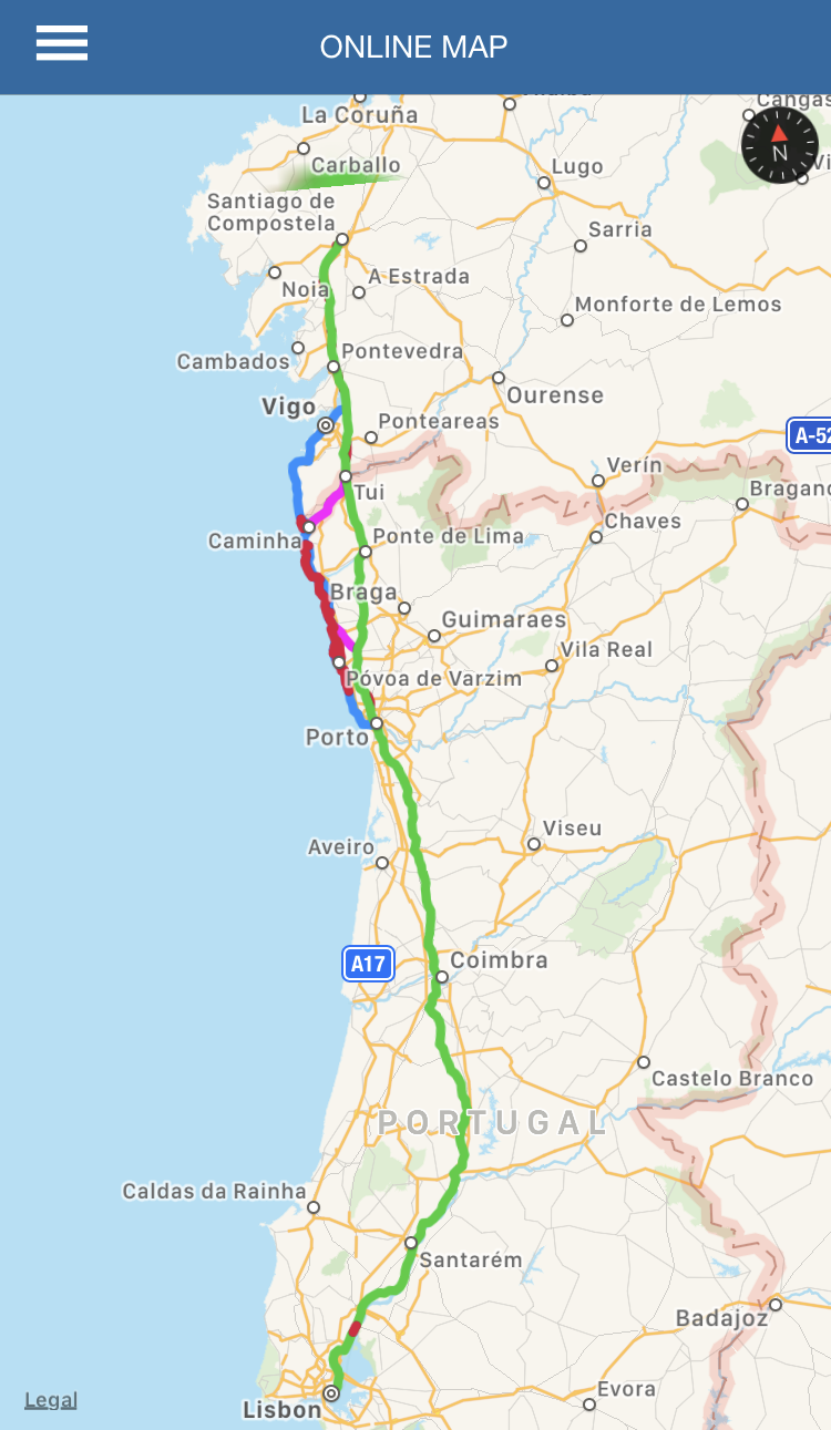
Camino Portugues is a trail that starts in the capital of Portugal (Lisbon), and runs north to Santiago de Compostela. It is one of the oldest trails in the Camino de Santiago network. Just like the other Caminos this trail will take you through some of the most beautiful towns and monuments in those areas. What is nice about the Camino Portugues is that you can do it forwards or backwards. Follow the Yellow arrows and it will lead you to Santiago, Spain. Follow the blue arrows and it will lead you back to Lisbon and all the way to Fatima, Portugal.
This summer my significant other and I decided to do the Camino Portugues on bike but due to time constraints we decided to break up our trip into two voyages. On bike or horseback the minimal distance to travel is 200km putting our starting point at Porto, Portugal. This guide will provide information about the towns and terrain as well as other useful hints.
The life saving app: Wise Pilgrim

After Porto there will be a significant stretch of Camino that will not contain yellow arrows. At this early stage of our trip for a significant time we felt lost and unsure of our direction. We ended up stopping at an information area that was familiar with the Camino (to get a stamp of course) where we were given some of the best advice we received the whole trip. They suggested to download an app called Wise Pilgrim (actually Wise Pilgrim is the developer). The app comes in different flavors depending on which trail you take. The one we bought was "Camino Portugues - A Wise Pilgrim Guide". Yes, it does cost $4.99 but it is well worth it!
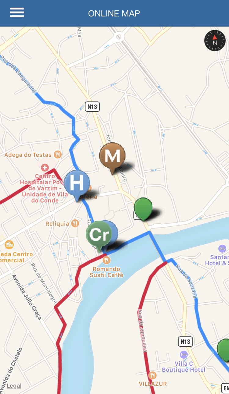
The app opens up a map showing you every stop and trail you can take. It will also show you the location of every hotel, public albergue, and private albergue along the path. It will also tell you the distance from one town to the next. Touching the green dot (as shown in the picture) will give you a cornucopia of information including if the town has a supermarket, hotel, train station, bus station, etc. The app does require an internet connection but if you read my article here, then an internet connection is just 20 euros away.
We are not endorsed by Wise Pilgrim nor did we ever have contact with them. We just like their app. That is all. We highly recommend the app for travelers on the Camino.
Guide
The Camino Portugues unlike the Frances has different branches one can take. It is hard to tell someone one path is better than the other as all the paths have some amazing things to see. In our case we ended up taking a path along the coast which was unintended. We decided to go up to Vila do Conde along the coastal trail and then cross over to Arcos which lies on the central trail. A path like this was not labeled on any map nor on the app but part way thru we started seeing arrows that lead us directly to Arcos.
I try to keep this guide spoiler free and pictures are just for reference. Have fun on your trip!
Porto - Vila do Conde
29.7 km or 18.5 mi
very easy
We had trouble trying to find our way out of Porto. We started at the cathedral on top of the hill and followed arrows down the stairs. We lost track of arrows and wondered down an alleyway where it was clear people were posted to sell drugs. After that, we wondered around asking every tourist information place we could find but no one seemed to know where the Camino ran through. Finally, we spoke to someone that told us to go down to the river, head to the coast, and follow it.
The river area is very beautiful and touristy. You can sit down and have lunch or just stop for some port wine.
The bay area was very nice with a dedicated bike path. This part of the Camino was very level and easy. At the tip of the bay there will be a light house. Follow the coast to proceed with the trail.
After passing the Queijo castle and the tiny aquarium SEA LIFE the path will run along the beach.

The cruise ship building is quite impressive.
While riding along the beach you will inevitably be able to see the amazing cruise ship port building. This building is in Matosinhos.
I would recommend you to stop at the information area at the edge of the beach just before the road to get to the cruze ship building. For reference its the building next to the statues of women who look like they experienced something tragic. These are the people who recommended I download the Wise Pilgrim app and are very knowledgeable on the Camino. After you get that stamp you can head towards the bridge.
What I would recommend is to head right from the information area on Rua de Tomaz Ribeiro. You should eventually hit a giant seafood restaurant (Restaurante Esplanada Marisqueira Antiga) and on the other side is a road for tram cars. Turn left on this road. This road is calm and filled with stores.

municipal markets glass doors. This hanger like building is filled with vendors of fruit, vegtables, and more.
Eventually you will need to turn right on this road. It will be signaled with a yellow arrow. This road will bring you next to the municipal markets. Housed inside a large building with glass doors are fruit and vegetable vendors. From here follow the road to the entrance of the bridge.
If you would like you can take a detour away from the bridge to see the Parish church of Matosinhos. It is an adorable church that is not too far from the bridge.
After the bridge keep following the coast trail. On your right you will pass the fortress Forte de Nossa Senhora das Neves then on your left a little ahead will be the Leca swimming pools which are filled with water from the sea.
On the right there will be a strip mall where you can find a super market on the other side. This strip mall is next to a McDonalds not to far from the Leca swimming pools. Super markets are life savers when it comes to saving money on the Camino.
After the bridge the trail is a red bike path along the beach. This is an easy ride. Of course if you are walking you wont be on the bike path but you will still be following it.
You will pass a very polluted area. It is so polluted that you can see the heavy pollution clouds before you get to this giant sewage treatment plant and oil refinery factory that smells extremely bad. Even after passing these two buildings you will be able to turn around and see the harsh separation between blue sky and heavy brown and grey clouds. This is the ugliest part of the camino.

walk along the red bike path to follow on the camino.
Most of the trail from here is on a red bike path or thru beach towns. The app seemed to have two different paths; one blue and one green. The green path went thru the beach and board walk which we assumed was for people walking as you cannot take a bike on the board walk. The blue path we assumed was for bikers as it dipped away from the beach every so often when the green path became board walk.
At one point the path goes into a small forest near the beach. The terrain is mostly sand with some of dirt paths. Unfortunately, the path that the Camino runs thru was destroyed and impassable even on foot. We had to circle back to a road and ride around the forest.
After a while riding thru towns you will be met with an amazing view entering the next town.

Have an ice cream in Barcelos to cool off.
Vila do Conde - Barcelos
28.4 km or 17.5 mi
easy but with some hills
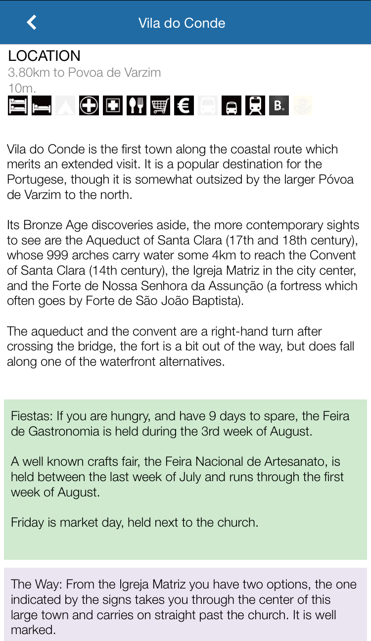
The sight from the bridge is very nice with a very attractive building on the other side. The town contains a Roman aqueduct. It has a few albergues and hotels if needed and all the amenities.

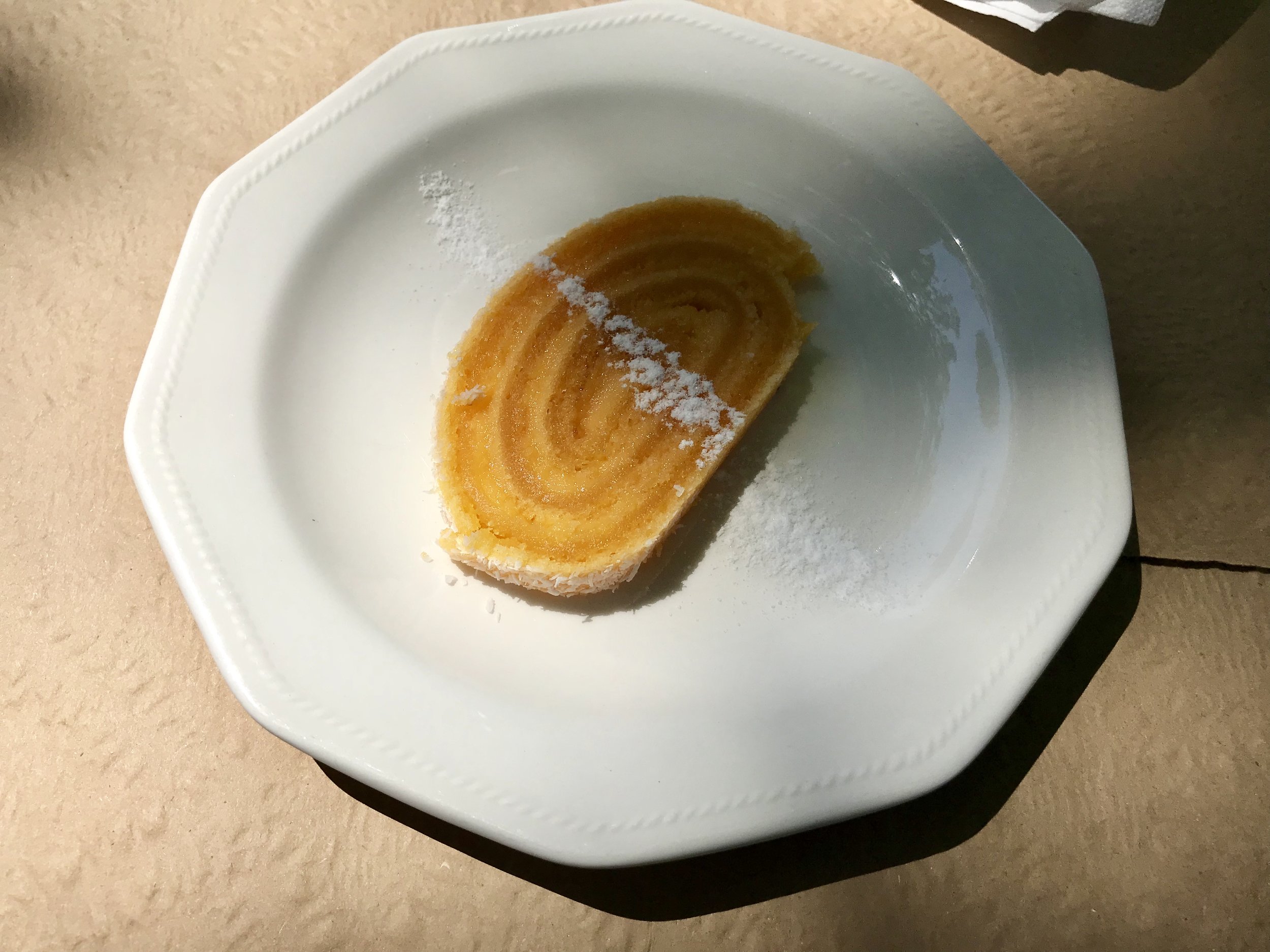
Entree for the 5 euro menu of the day meal.
We ate at a restaurant near the albergue that had a meal of the day for 5 euros which contained a cup of soup, a main dish (with a good amount of food on it), a soda, and a coffee or shot. This menu was served almost all day unlike other places that only serve meals of the day at lunchtime.
From here we cut across eastward to get back onto the central trail from the coastal trail. This path was quite easy and ended up being marked with yellow arrows. We followed a major road along the river as shown on the image. This was all normal roads and not as plain or level as before. Caution is advised from here on out to Barcelos as people in Portugal drive very fast and there will be a limited amount of sidewalks.
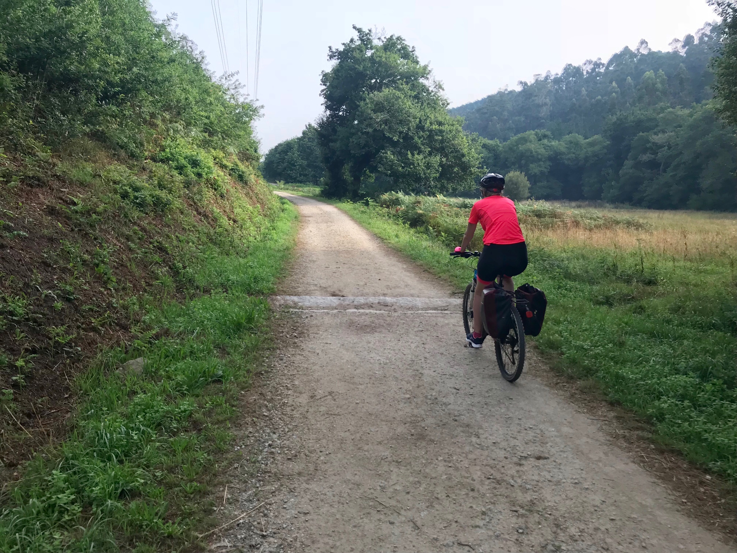
After a while you will pass thru some dirt roads every once in a while that ran in between corn fields and sometimes sunflower fields. On bike these roads are a pain to ride on. Sometimes you will be forced to push the bike on foot. Even on foot these trails can be quite rocky.

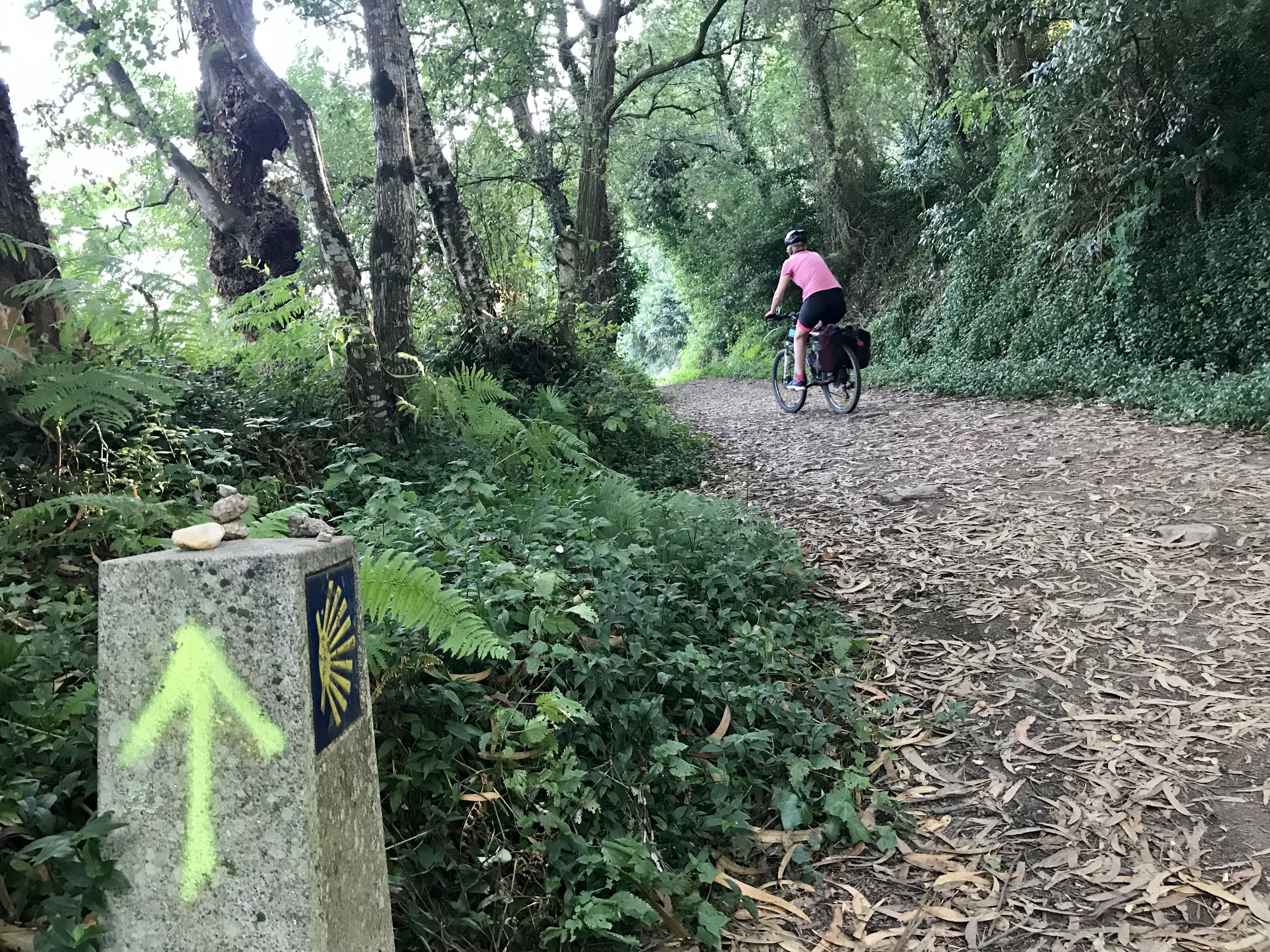
Small monument leaving Vila do Conde. You can expect to see things like this litered all over the camino.
You will inevitably find yourself on what seems like cobblestone roads. This turns out to be authentic roads laid by the Romans. They are uncomfortable to ride or walk on.
You will experience a combination of Roman roads, normal roads, and dirt paths from here on out.
Before entering Barcelos you will be met with a beautiful view of a green pasture and written in colorful plants the word "BARCELOS". This sits on the other side of the river along with a mill crested with the scallop shell, a palace in ruins, and an original roman bridge. I would suggest you do not cross the bridge just yet and take some pictures from the benches to the left of the bridge. This is where i took the thumb nail picture.
Barcelos - Ponte de lima
34 km or 21 mi
medium to hard with short but steep hills
Barcelos is a beautiful town with a few churches, a palace in ruins, gardens to walk around and a charming pedestrian street. This is another great place one can stop to rest or sleep. I was told the fountain in this town was safe to drink, so I filled up my water bottle. I did this a few times at fountains we passed even if I was told it had not been tested. I never got sick. This is one of the best parts about the camino is the amount of free potable water along the trail. If you have any doubts you could always bring a sawyer squeeze or mini.
Leaving the town we used the app. The next stages will be a combination of roads, dirt trails and roman roads. Their will be some steep hills and bars are much more scattered. There is not much to talk about here. Like the rest of the camino you will approach on churches and monasteries every once in a while.

Casa Fernanda
In between the towns Outeiro and Fernanda you will find an albergue Casa Fernanda. Fernanda is a wonderful women and even if you don't stay there you can go in, say high, and rest your feet.
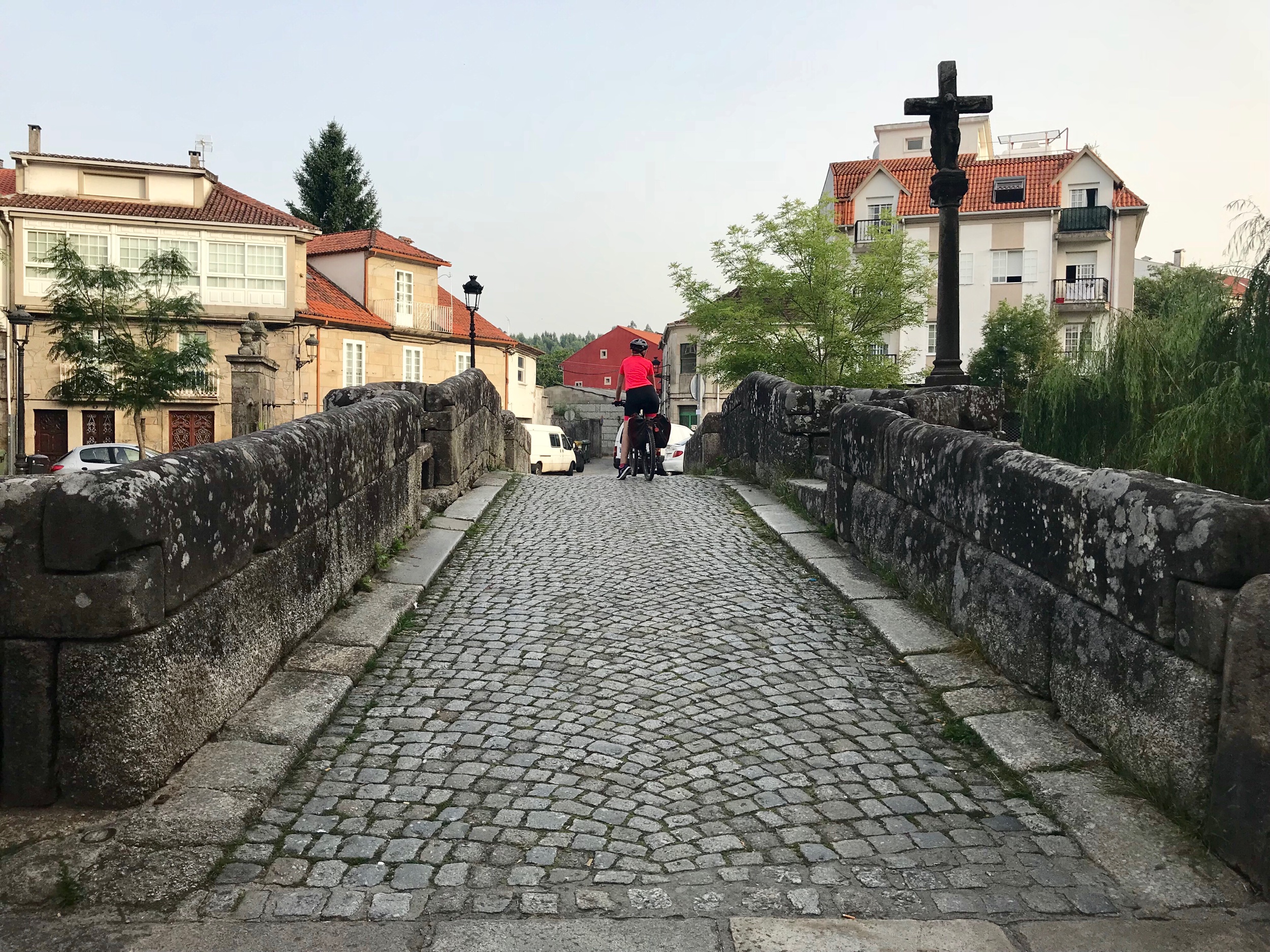
The entrance to Ponte de lima was my favorite view of an approaching city. Ponte de lima has a medieval tower, roman bridge, and a beautiful view. Take a dip in the river if you need it.
From Redondela to Tui.
Ponte De Lima - Tui (Spain)
35 km
Very hard to medium
From this point on arrows will be easy to spot and you will most luckily won’t need an app to navigate the camino.
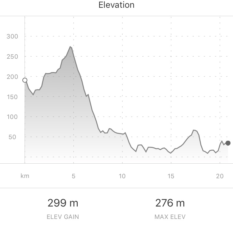
The hardest part of the camino is right after Ponte de Lima. A grueling 14 kilometers of impossible to ride terrain, and when I say impossible I mean you will need to carry your bike on a shoulder and climb rocks. This climb is called La Bruja.
For hikers this is just a demanding climb, but for bikers it is incredibly difficult. I heard rumors that you could ride on the road around the La Bruja. I suggest you look up videos of La Bruja just to see how demanding it is.

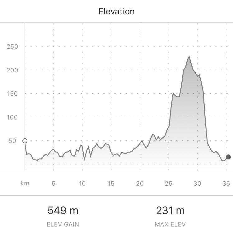
Once you get to Rubiaes everything is “smoother”. Some uphills with loose rocks and downhills on old roman roads made of stone. After Rubiaes I started using my strava app so you can see the elevation change.
We found a kind lady who gave us free lemonade and who also sold fruit for 1 euro. If you stop she will ask to take a video of you for her instagram.
After the fruit lady you will be traveling through small villages most of the time with many restaurants and bars. I also passed quite a few fountains, but without signs stating if it was potable so if you have a sawyer mini on hand you should be good with water or as stated before you could probably drink it and not get sick.

When you get to valenca you will pass a beautiful park that lead to the great wall of valenca. I suggest you stop to sight see. Valenca is beautiful city surround by a star shaped wall. The camino was supposed to go through the old city within the walls, but due to construction I had to go around. The main attraction of Valenca is the wall which you are allowed to climb. If I remember correctly the first time I went there was a museum that detailed the wall and the history of the town.
Before crossing the bridge which takes you into Spain I stoped at the last restaurant in Portugal, Fronteira Gastrobar. For 7 euros I had some of the best pork skewers I have ever had, soup, desert, and a large bottle of water. Once you are done in Valenca you can head to the bridge to cross into Spain. I suggest you cross on the right side as you get a nice, yet far, view of the cathedral over the river.
Just over the bridge is Tui, Spain. During medieval times Tui and Valenca were in perpetual battle. Now they are two medieval towns that sit a couple kilometers away but in two different countries. Tui’s historical part is charming and the cathedral is worth seeing.

The bridge that takes you from Portugal into Spain.
Tui - Redondela
35 km
Easy in beginning and Harder at end
You are now in Spain. Through Tui it will be mostly stairs and roads until you get out and then you will be on good old dirt trails with some roads.
Once you get to Poriño you will be traveling through roads and through towns. There will be a pazo that will be worth glancing over at. For those unfamiliar pazos are houses that royalty or the weather lived in during the olden times. Some pazos can be of grand scale and are found all across spain.
When you start getting close to Rendondela, maybe 10 kilometers away, there will be some steep hills. This will keep up until right before Rendonela where it will be steep declines. Some of these declines were so steep that I thought i would flip over my bike if I stopped to hard and yet I had to grab all of my brakes just to slowly descend.
We ended up staying in an albergue A Casa da Herba which I would recommend. They have private rooms.

Redondela - Pontevedra
20.6 km
Medium to Hard
After Redondela it will be all uphill for a while. Dont get to comfortable when the downhills appear because a few kilometers later there will be another massive uphill. The first few 15 kilometers will be tough with never ending climbs and extremely steep descents. In some cases the climbs are very rocky trails that you can not ride a bike on. Be careful with rolling your ankles here as well.
There will be two intersections today that are very dangerous. The camino passes through them but both or one side is blind and the cars drive quickly. Be careful!
For those who have a filter I noticed many fountains in this stage so you are in luck.
You will eventually pass Ponte Sampaio which has a small captivating bridge with the river Verdugo, a river that leads into ocean in Vigo, running underneath it. On this bridge took place a battle against Napoleons army which ended with Napoleon withdrawing from Galicia. You have been riding on authentic roman roads that have most likely been utilized during medieval times as well, and now across a bridge that Napoleonic troops fought a battle on. I do not know about you but i find it fascinating to be traveling the same roads, in the same manner, as these ancient people once did.

After the two large mountains you climb the trail is relatively level and easier. After the yellow arrow in a blue square (this is the first to appear but from here on out you will see many like this one) it is down hill and then the mostly level ground until Pontevedra.
I suggest you make Pontevedra your stop for the night. Pontevedra is a large and beautiful city with many restaurants, history, and a prominent nightlife. Things you may want to see include Capela da Peregrina, Iglesia de Sanra Maria la Mayor, Ruinas de San Domingos, and Convento e Igrexa de San Francisco. If churches and convents are not your thing then you could go see the museum Sexto edificio.

Pontevedra - Padron
40.7 km
Medium to hard
After Pontevedra you will be traveling through towns for a while untill you hit the cobblestone roman roads. We were told water would be scarce on this trail but we found water flowing across and along the trail quite a few times. With the proper filter you could drink from these. Also you will quickly pass two fountains after Pontevedra.

The trail will mostly be on dirt roads except for the rare excursion on a road or to cross a street. There will be some tough climbs on the way. There is not much to say about the path untill you get to Padron. As you get closer to Santiago the trail becomes a path through forests and along fields with not much to talk about except for the major towns you pass through.
About 2km from Padron we stopped at a Bar run by a man who in all accounts should not be running a bar. In hindsight I could only assume this man is mentally ill. The man charges for his stamps through a sign suggests you should “leave a tip” if you plan on stamping. If you dont he will very... very rudely serve you. The man also doesnt know when to shut up and just kept harassing this one family as they were relaxing and feeding their kids some sort of strange raw mushrooms. If I were to guess is this man poisons unsuspecting pilgrims with his raw mushrooms and then grinds them up into his homemade chorizos... but im only making an educated guess here. The bar had no name but if you walk into a dirty bar in the middle or edge of a small town with knight and templar flags hanging from rafters then I suggest you turn around and run.
Once you get to Padron I suggest staying at the albergue called Camino do sar. It was a fantastic albergue run by a family who is really passionate about the camino. The sleeping area are very comfortable pods with lockers and clean bathrooms. There is a kitchen are and even a pool in the back. There are a very limited number of spots so I suggest reserving before hand. Many times did the family offer to pick up beer, food, and even wash our cloths for us. At 15 per night with breakfast included I can see why this place has a 9.5 on Booking.
Padron is nationally famous because of its peppers de padron. These are the small fried peppers that are sometimes spicy. Padron is a small town but is worth walking around in and enjoying dinner at.
Padron - Santiago
20 km
Medium to easy
To be honest I didn't take much notes on this day. Most of the trails converge at one point today so If you have done any caminos in the past they might start to look the same at one point. The trail will almost exclusively be dirt paths with some asphalt roads. Just enjoy your last day on the camino.

The only noticeable part is there will be a divide in the trail at one point. A stone post will point in two different directions; Santa Maria and Concho. If you go right you will add a couple of km to your journey and will pass through a monastery. If passing through churches and monastery is not your thing then I suggest you take a left.
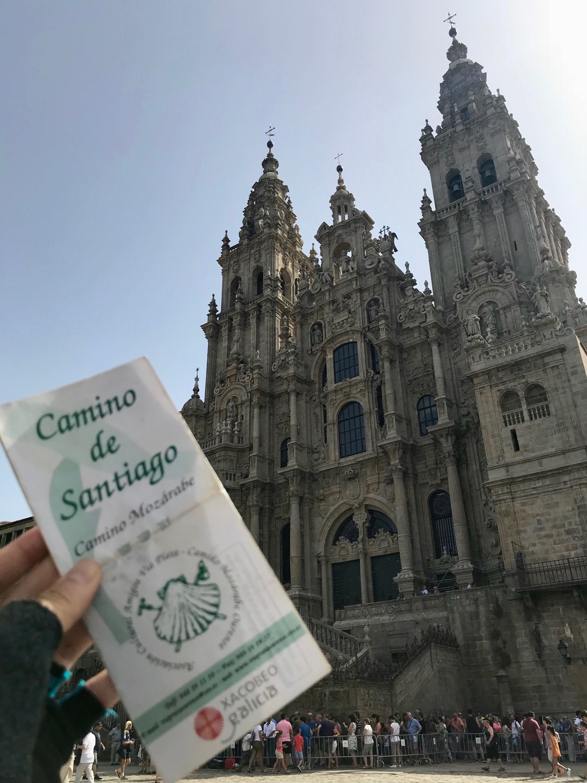
You journey is almost over. Soon you will see the cathedral protruding above the buildings of Santiago. Once you get to Santiago you might want to take a picture in front of cathedral in victory and some even attend the pilgrim mass held daily at noon or 7:30, everyday. If you want to redium your official certificate head to Pilgrim’s office with your completed passport. A map below will show you the way.
Finally, I would like to issue you a congratulations. You have completed one of the most famous through hikes in the world. You have seen some of the most spectacular places in Portugal. But dont make this your last time in Spain. There are many more Camino trails for you to concur. Now go bask in the glory of a completed Camino thruhike.